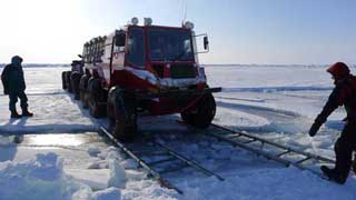
Wednesday, April 20, 2011
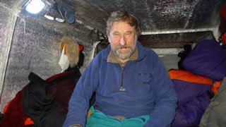
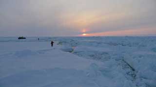
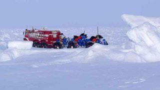
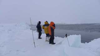
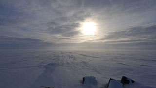
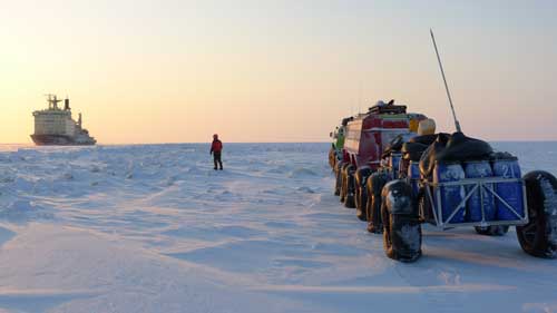
Cloudless sunrise after frigidly cold night. Atmospheric pressure has gone down. Wind is out of the south. Light snowfall. It is splendidly nasty. I am sitting on Golomyanniy island Polar station. Behind are seemingly endless 24 hours of driving over shore ice belt of the island Oktyabrskoy Revolyucii. Further on, closer to Sredniy island, border guards make us promise to join them tomorrow in banya. And at last, the long awaited “polyarka” Polar Base with sourdoughs – Lutchnko and Omelchenko. Anatoliy is a young father of Svetlana’s two year ols boy. He is leaving for the continent in a few days. Igor Mihaylovich, on the contrary, has just recently entered the duty and along with two young meteorologists will remain here until spring. It partakes of homecoming. Laughing, they hand us our own forgotten here last time, towels and our two boxes full of metal scrap parts and engine oil are sitting there untouched from last visit. We will stay here for three days to do some maintenance work on vehicles and gear and to rest a bit and will head out once again. Although we are not yet certain if we will move north or south from here. Today’s task is to get in touch with all the competent sources and to get as accurate description of ice situation an movements for today. |
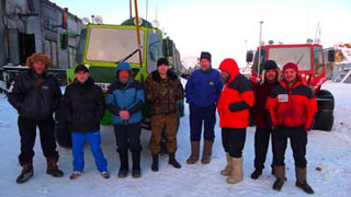
Russians in the Arctic. Russian MLAE-2011 Expedition on Golomyanniy islan |
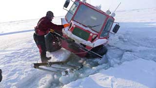
We are presently on Golomyanniy. Water is on three sides of the island. Anatoliy Omel’chenko who is here since the year 1991 and and he says that it is the very first time he sees it at this time of the year. We give ourselves two – three days to make the decision. Fortunately neither vehicles nor the gear require any serious repairs. Both Va’nkov and Zaitcev keep their restless hands busy implementing the improvements modifications thought up during the many long hours spent breaking the ice on the way. We will make the decision and we will immediately make it known to all of you, our continental friends. Posted by Vasily Elagin. |
Russian Arctic Expedition MLAE-2011. Russian Arctic Ocean ice Expedition. |
Saturday, April 16, 2011
It's green one... |
Hi Great Earth! |
It's red one... |
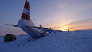
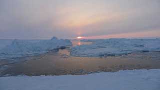
Severnaya Zemlya, Golomyanniy island. Oh! At last!! Saturday, April 16, 2011 7:30 N79° 33.919 E90° 33.939' | ||
Friday, April 15, 2011
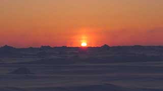
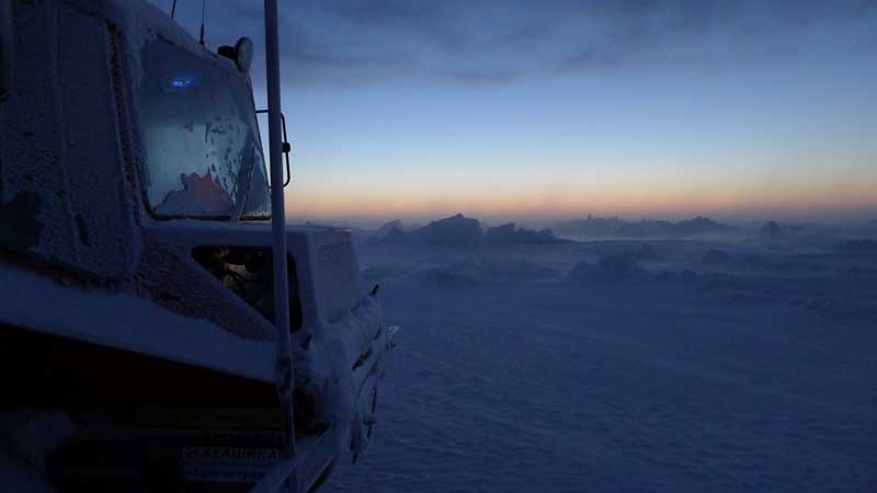
Getting through to Severnaya Zemlya has been quite something else. Not since the Pobeda Peak have I had to work this hard. The “warm” Kara Sea apparently had no intent of letting us leave it. Though it is starting to seem as though we are finally parting. I will never forget this pond, though. The view outside is beyond what Roerich could have dreamed up. A pastel-like sunrise, day-night. Outside is bright, ridges, icebergs, shore. We think to reach Golomyanniy Island by tomorrow night. The shore ice belt is solid. Although, every time we begin to dream is exactly when s@#%* happens. We shall try, though. Wind is moderate, inside the vehicles it is warm and in our sleeping bags – even warmer. Overall everything is great. Posted by Sergey Isaev |
Roerich never dreamed of ... |
Thursday, April 14, 2011
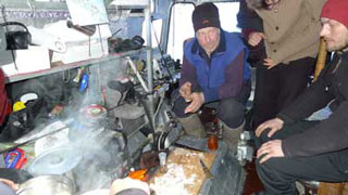
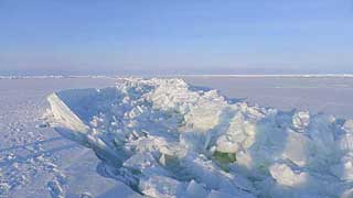
We got a good night of sleep in and the weather conditions improved, as well. Visibility is decent. First few hundred meters of traveling along the floe we spend the night on were deceivingly easy and had settle in rather a worry free disposition, considering that the shores of the Novaya Zemlya archipelago were some short 17 km away. These 17 kilometers however proved to be anything but short or easy. Heavy ridges with practically no flat spaces in between them, covered with freshly blown over deep fluffy snow. Vehicles, despite of their light weight and off-road prowess, could travel no more than a 100 meters at a time without needing assistance from the men, who then themselves had to put quite a bit of effort to cover these 100 meters on foot to catch up to the vehicles. The snow cover was so deep that each step of the way could come with a surprise sinking into the deep snow sometime knee deep, sometimes all the way to the armpits. Obihod did just that, and only remained afloat by spreading his arms wide to his sides to keep himself from going further down. Both Isaev and Zaitcev had to resort to “all—wheel drive” climbing snow banks on all fours. While yours truly, would climb on top of Yemelya’s roof every 100 meters with the hope partaking of the one Lenin must have cherished long before him – of seeing the way to the brighter and better future ahead. |
As Lenin at the Finland Station |
The vehicles with the caravan of trailers in tow twist like snakes between creations of ice and winds, their shapes reminiscent of pagan idol statues of Easter Islands standing on guard of this seemingly endless, silent grandeur.
By midday we made our way through to the area of lesser density of ridges, drove for several kilometers and just as we began to relax, the Kara Sea did not fail to surprise us with a large crack in the ice right across the direction of our path. It stretched as far as we could see in both directions. We were at this point exhausted and bewildered by the previous few hours of battling the ridges and could almost smell the land so closely ahead that we decided to risk crossing afloat. One hour later we were driving again. Two hours later we raised a toast to reaching the Land.
Posted by Vasily Elagin. |
Fields sparse hummocks |
Tuesday, April 12, 2011
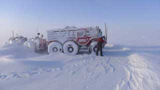
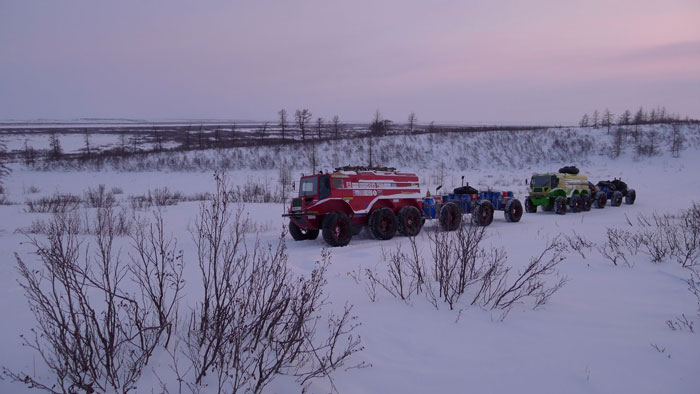
Just 50 years passed since man first flew into space. The world back there, on the continent, has achieved amazing technological breakthroughs, and here, in our Kara Sea all remains unchanged, untouched pristine and primal as it has been for hundreds of thousands of years – the ice ridges, useful seawater, snow, wind and - though scarce this year – sun. The return back to our route has - because of unfavorable weather and terrain conditions - become a journey of itself, and tough one at that. Odometer reading of our navigator instrument is at 2715 km. The vehicles are standing up to our expectations and even exceeding them –capability of crossing tough ridged terrain is nothing short of incredible. The hull-bodies are completely watertight and amazingly spacious and comfortable for the crew day and night. Even a tall person sleeps comfortably on beds positioned across the vehicle body width for the night, shelves, drawers and all is about as well laid as in a recreational family mobile home. |
 Yemelya vehicle's spacious interior |
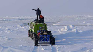
Our nomadic lifestyle is tuned up at this point and we have gotten used to it. Our journey to the North continues slowly but steadily. We proceed in the following order: five men in the lead vehicle – driver, cameraman recording all the dramatic as well as not so dramatic moments for future generations to see, the sleeping body of the watchman, and two fellows who jump out of the vehicle just before every stop in front of an obstacle, grab their two ice picks off the special holders on “Yemelya’s” front bumper and let them loose on the icy obstacle. Two men are in the following vehicle, the driver and the condolent fellow-traveler whose job is to admire the driver’s skill and to condole him through the moments of hardship. They also, root for the lead vehicle team and timt to time even ask in voices full of hope for the negative response – “Do you need help up there?” Thankfully our wise commanding authority rotates the staff of both crews daily so as to assure a well-balanced personality development of all expedition members. And thus we proceed. All the best and well-balanced to you. Posted by Vasily Elagin. |
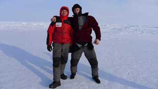
Yemelya-4 vehicle easily accommodates seven man crew |
Sunday, April 10, 2011
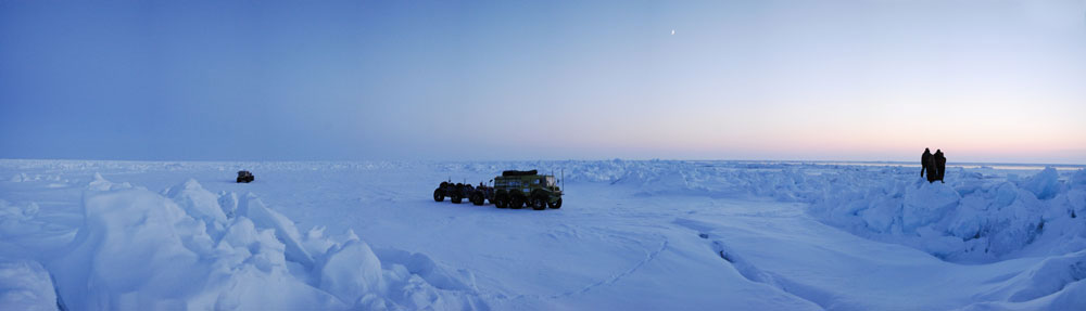
As per the advice of Bychenkov from AARI (Arctic and Antarctic Research Institute) “to look for our last chance East of us”, we did turn East and there it was. After four short hours of sleep we attacked our the ridges befringing polynya and by 1300 hours found ourselves upon the floating ice of, by now familiar to us, Kara Sea. Many thanks for the correctly interpreted and timely delivered to us images of the ice! |
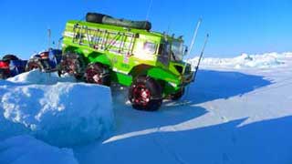
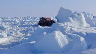
 Attacked to huge hummocks |
We traveled on fairly uncomplicated terrain, for a while, but short lived was our joy and we very soon encountered ridges reaching out as far as the horizon. Polynya that stretched along our path to the right of us came to save the day. It was covered with ice we could drive on. But only fast, we could not stand or stop on it. Occasionally there were pitfalls. We moved along the “shore” at full throttle, solving problems like “30 degrees – water!” on the fly. Thus, dodging water holes, we ended the day upon one cozy ice floe with the coordinates of N78° 30' and Е93°. Posted by Vasily Elagin. |
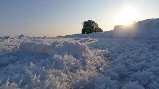 Salty Crystals |
Friday, April 8, 2011
I’ll keep it short today due to tiredness. The ice floe itself has drifter off, leaving us on the shore ice belt by 04:30 hours on Sivash. A large bearded seal watched us as if wondering: “what are they doing wondering around here?” And we would be happy to leave ourselves, yet the Kara Sea has got a hold of us and does not let go. While our avant-garde went to off to check the ice situation around, we did a complete inventory of everything: ropes, diesel, manhood and humor. From the looks of it we are still doing alright. Posted by Vasily Elagin. |
 Clinch by Kara Sea |
Thursday, April 7, 2011
We are presently near Voronin Island. A tall lighthouse is visible from here, but we are separated from it by a large polynya ranging from 300 to 3000 meters in width. To cross over to the shore ice belt we need to find the place where the polynya is most narrow. Wind is out of North East and strengthening. Driving north along the polynya we find a narrowing of no more than 200 meters in width covered with thin ice. Men come out on the ice with the picks, and report back that they think the vehicles without trailers will be able to make a dash and reach the water without falling though the ice. Factoring in the wind we pick the spot on the other side where to get out of the water. The decision to cross afloat is made. |
 Large polynya near Voronin Island. |
We prepare the boat, the blocks, the dollies and Kevlar hawsers; we designate responsibilities and roles between members of the crew; everyone will be involved. By now the thin ice cover begins to tighten around the open water until it vanishes right before our eyes. The water still, however, remains open to the right and to the left. Our only chance at crossing now is to drive fast over the thin ice and dive into the still uncovered water. |
 Vanished into thin ice |
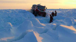
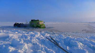
Ice fields close over the water completely and begin to crawl onto one another and soon become drivable The vehicles are speeding over 12 sm ice. It is sags, but holds! Now trailers. We have six of them. The “dispatcher” gives the go ahead to the first “train” consisting of three trailers. Kevlar cables are tied to the hitch of “Yemelya-4”, guide dollies with blocks are stuck into the ice and the “train” is underway. Going over a stretch of thin ice the trailers fall through it and are now floating on their tires. Our team gets to pulling the cables by hand to help “Yemelya” and eventually the trailers with our food, fuel and personal belongings roll out of the water and onto the ice. All things are safe, secure and dry in the water tight plastic barrels. Second train overcomes shorter distances from one ice field to another. We gather all the metal gear. Posted by Vasily Elagin, Afanasiy Makovnev. |
 Vladimir Obihod |
Wednesday, April 6, 2011
The expedition has covered 2558 km since leaving Urengoy. We are currently at the latitude of Voronin island and seven kilometers to the east from it. In front of us is polynya. It separates us from the long-awaited shore ice belt which we believe continues all the way to Sredniy island. Last three days were spent battling the ridges and polynyas. We had never before in all of our preceding expeditions to the Arctic encountered such density of obstacles per kilometer. Kara Sea fast tracked our new recruits’ apprenticeship course. Each day requires the use of the entire arsenal of our ice ridge negotiation instruments. Ladder driving course. |
 Yemelya-4 crossing open water in Kara Sea, Arctic Ocean. MLAE2011 |
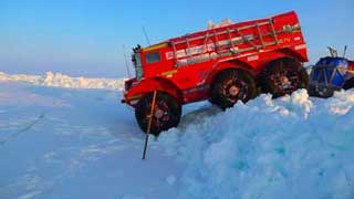
In the Kara Sea we encountered a thoroughly new to us type of obstacle: fields of pancake ice with round “pancakes” from 5 to 20 meters in diameter, with icy snow fringes, some over a meter tall. Between them – cracks up to a meter deep. Driving over these, “pancakes” is and experience you wouldn’t wish to your worst of enemies, not to mention our beloved “Red” and “Green” buggies. They drive over this horrible terrain in first and second gear while managing to pull three trailers after them, which puts great strains on their transmissions. But thus far the machines are handling it well. We all miss our friends and relatives and send greetings to everyone back home. Posted by Vasily Elagin. |
 Yemelya-3 sliding off into polynya, Kara Sea, Arctic Ocean. MLAE2011 |
02 April 2011
It is our third day of travel from Russky Island to Sredny Island of the Severnaya Zemlya Archipelago. The numerous breaks in the ice – which we jokingly call “rechushki” (little rivers) – are beginning to get on the nerves. We are moving northwest, farther from land in the hope of finding places with less hummocked ice. We are happy with how our vehicles behave – they keep moving! Although at times the ice is so rugged that we have to mainly use the first gear and only sometimes – luckily! – the second gear. We also use ladders that we tied up together beforehand when we were still on Russky Island waiting till the storm was over. And we have had to use ATV hoists a couple of times, ice anchors, blocks and latch hooks. It all sounds fascinating, but in reality the main tool used for making one’s way through the Arctic hummocked ice is a good weighty ice axe. Chopping and clearing ice away is actually the main secret of auto travelers in the Arctic. |
 Arctic hummocked ice |
Twice a day we had to get over crevasses during active ice movement by using ladders. The trick is to lay the ladders in the right place quickly and accurately so that the driver would be able to quickly move all the six axes of the “auto train” over them. Sometimes the hand would falter and the vehicle would slip sideway – and into the warter. Well, here you are then, pulling it out to save it. In a word, there’s never a dull moment – the ice axes never get rusty, so to say... The odometer indicates 2,403 km, that is, we have to go another 250 km to reach Sredny Island. I wish the ice were easier. Or it would mean the Kara Sea proves its name [“kara” means punishment in Russian], although I can’t understand for what, really. Vassily Yelagin |
The ice axes never get rusty |
April 1, 2011
We are OK, zigzagging among the ice cracks in the Kara Sea, North-West from Russky Island, course between 345 and 020, in the direction of Golomyanny island. Yuri Demyanivich Bychenkov sends us very good photos of the ice cover showing the network of cracks, and this helps us in choosing the strategy of the route – now we want to move to the North and then – to the North-East, to Shokalsky Strait, in order to drive further along the shore-fast ice of Severnaya Zemlya. Kilometrage during the day: 28 km, distance from the place of overnight stop is 20 km, it is a good ratio. Afanasiy Makovnev. 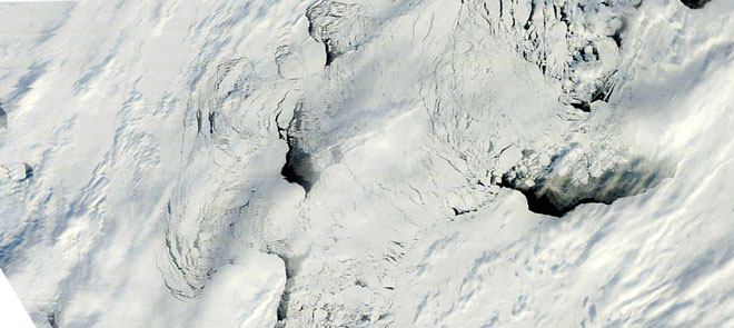
Picture from satellites with a resolution of 250m. |
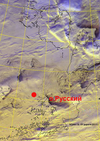 Picture with satellite location area MLAE 2011 |
March 31, 2011
In the evening of the 29th we reached the first ice hummocks located to the South from Russky Island, on the 30th the whole day we passed the hummocks and ice broken by hummocking. We managed to pass 8 km. On the 31st we passed just 14 km. We drive round the SW extremity of Russky Island, from each high hummock we clearly see the familiar lighthouse near which we stayed for several days during the snowstorm. Afanasiy Makovnev. |
 Hummocks south island Russian |
March 30, 2011
We have left Russky Island, turning around it from South-West, now directing to the North. We passed several ridges of hummocks. This must be seen by own eyes, I did not suspect that something like that is possible. Location coordinates by 21:30, Moscow time: N76° 55.818', E094° 59.894' Sergey Isaev In reply to the request by Vasily Yelagin to provide "trustworthy information related to ice condition in SE part of Kara Sea" we received a letter from Ivan Kuzhelivsky, member of MLAE-2008. Good day, friends! |
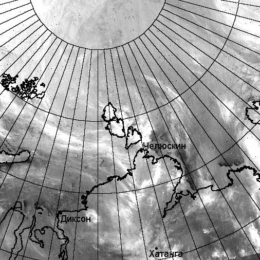 Map cloud satellite data Meteor-M |
March 29, 2011
If you go to the left – you will lose your horse, if you go to the right – you will lose your life… Not wishing to lose any of the above, we are staying already for five days and waiting for clarification of ice situation in SW part of Kara Sea. From numerous phone talks we get to know that such weather did not occur here for twenty years. The “veterans” of the team have philosophical attitude towards compulsory waiting, while the young people, naturally, are anxious to go. The attempts to provide continued occupancy for them were in vain, there is not much to do, and they do everything quickly. We calculated fuel consumption at the distance of 800 km from Dikson Island to the place of stay: 35-36 liters per 100 km along routes of average difficulty with a caravan of three trailers for each vehicle; this corresponds to the estimated value and gives hope to perform the travel in autonomous mode. |
 Water around the island Russian |
The team has split – the crew of the green vehicle sleeps crosswise the cabin, while the crew of the red vehicle sleeps along the cabin. V.I. Yanochkin received an assignment to investigate, how this fact is related to the vehicle color; perhaps a fundamental treatise will be written on the topic, and a Ph.D. thesis will be defended. Vasily Yelagin. P.S. Dear readers of the news, we will be immeasurably grateful if you help us to get trustworthy information related to ice condition in SE part of Kara Sea. |
 Morning March 29, 2011 |
Sunday, March 27, 2011
We lost four days in the vicinity of Russkiy island due to extremely unfavorable ice movements. Southerly wind shifted the ice away from the Nordenshel’d Archipelago and we therefore still have not had the chance to cross over to the drifting ice cap. Barometric pressure is low, weather is warm and extremely unstable. We are taking care of minor chores and maintenance work. We added another pair of aluminum ladders to the old ones that we had tied together to implement them as improvised bridges over narrow clefts in the ice. Afanasiy seems to have shared the secret skill exclusively to Sergey Isaev and they are now the only two enlightened in possession of the secret Eskimo rope and cable knot code. |
 Ridges forming in Kara Sea |
We are waiting for Northern winds to improve the ice positioning. We are standing still near a wooden lighthouse tower on U-3 extremity of the Russkiy island. The lighthouse was built in 1961, it is 20 meters tall. and it used electric batteries as well as acetylene to produce light. It was most likely maintained by the staff of the polar station located on the north side of the island. Posted by Vasily Elagin. |
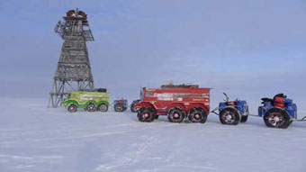 Russian Arctic infrastructure 1961 lighthouse in Kara Sea |
24 марта 2011 г.
Blizzard persisted for four days. Warm, up to -7 С°, low drifting snow and whiteouts. Strong wind. From Dickson on the Arctic seems to be throwing at us all that its got. Clenching our teeth we push forward looking at GPS and the map on computer screen more than through the windshield and reach island Russkiy. The vehicles and the crew are behaving well. We are on the move 24 hours per day. Nightshifts are easier than days as the ridges and terrain is easier to read at night in the light of our projectors, than in the milkish whiteout of the day. |
Blizzardy weather |
We come across an abandoned Polar station on the Russkiy island, its windows and doors are taken broken by the bears. Strong Arctic wind creates another polynya that stops our progress to the North. We send greetings to all our meteorologists (Day of a meteorologist in Russia), wish them luck in everything including their witchcraft job. We have a celebration of our won as well: today Afanasiy Makovnev, turns 49 and invited us to celebrate with him. All’well, and our best wishes go out to everyone on the continent. Posted by Vasily Elagin. |
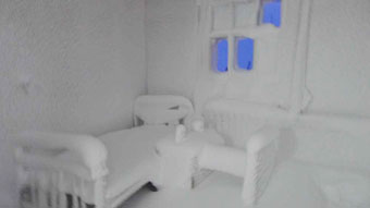 White room |
The expedition is currently on the Russkiy island in Kara Sea and the island is surrounded by a large polynya. The crew is searching for a passage to move further North to the Severnaya Zemlya. Coordinates on 16:00 MSK:N77° 1.847', E95° 32.401' Posted by Afanasiy Makovnev. |
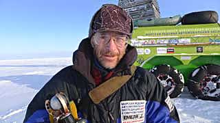
Afanasiy's birthday |
Friday, March 16, 2011 г.
We were maintaining heading 0° to Dickson and had 50 km left to go. Our “train” was driven by Vladimir Obihod. As we were crossing Cape Mys Efremov, a stretch of large hummocks and ridges crossed our path. Looking through his binoculars, Obihod saw a large and even field within about one kilometer from the shore and decided to drive on it. To the right he noticed an expanding crack in the ice. He came outside the vehicle and with the sticks of his ice pick checked its thickness. The ice was 25 centimeters thick and wet, but held the vehicle weight well. The crew was asleep. Vladimir woke everyone up and at the same time the crack began rapidly expanding and new cracks began to appear to in front and to the rear of us. It was the result of ocean tide. We attempted to move West – away from the shoreline we needed to eventually reach. Than we found the narrowest place (45m) to cross back to the east side. We inflated the boat, and got out the Kevlar rope. Sergey Isaev and Vladimir Yanochkin crossed over to the other side in the boat, tightened the rope and set up the crossing. In the mean time our mechanics inspected seal gaskets on the driveshafts. One of the had to be replaced, and while we worked on that, the ice floes came together allowing us to cross over driving. Temperature is at -30°C, it is nice and sunny. By 21:00 hours we reached Dickson arrived in Dickson to the warm welcome of the border guardsmen and old friends – Vladimir Demchuk, Valeriy Savin, Vladimir Krylov.
Coordinates on 21:00 MSK: N73° 30.438', E080° 31.131'.
Posted by Afanasiy Makovnev.
Monday, March 15, 2011
Russian Atomic Icebreaker vessel Taimyr on Yenisey River
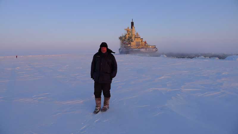
We have covered 1230 km. 120 km left to go until we reach Dickson. The vehicles, trailer and the crew seem to be tugging along smoothly. The breaking in period is over. Expeditions is picking up the pace. On our way down to Yenisey Bay we stop in the old village of Karaul. We meet good people here. Nenets Svetlana and Rostik Vaenga sold us freshly frozen whole deer (a 30kg female). Michael Aliev and his relative Zulfin – both from Azerbaijan presented us with 2 bags of whitefish and three sturgeon heads for fish soup.
Russian diesel operator Dima sold us a barrel of freshly caught sparling (on the shores of Yenisey River they call it “zubatka”) We exchanged three long siren blasts with a captain of a large atomic icebreaker ship “Tymir” that passed 200 meters away from us in “the opposite lane”. Upon noticing us the captain halted the machines, stopped the vessel and then commanded full steam ahead and the huge machine’s black and frost covered hull side passed above us, crushing the ice underneath it. Huge ice floes behind the vessel were being carried along the canal. The might and power of this atomic reactor powered lunker next to the fragile “Yemelyas” is well captured in the photos and video.
Coordinates: N70° 28.396', E083° 22.409.
Posted by Afanasiy Makovnev.
Monday, March 14, 2011
|
The expedition proceeds along on the ice of Yenisei River. We bought 70 kilos of Sig fish in Karaul village. Karaul – ancient village founded in 1616 as a guard post. A winter hideout for travelers and traders at first, it later becomes home to settlers. Prominent Arctic explorer – F. Nansen describes Karaul of early 19th century, in his “Into the country of Future” : “This is an important fish trade hub of the Yenisey River and belongs to a rich merchant from the city of Krasnoyarsk. There is fairly large and substantially build house in it and overall it is a large modern village.”
Our current position at 08:00 MSK time is: N70° 28.396', E083° 22.409.
|  Sunset |
Thursday, March 10, 2011

Between March 4th and 9th the expedition traveled close to a thousand kilometers on the Vankor-Neft’ ice road and reached Dudinka. The vehicles traveled on the ice road at the speeds of 10-15km/h, covering up to 200 km daily. The ice-road runs over the frozen waters of Enisey River. The Hydro dam in Krasnoyarsk had recently been drained and under the snow of the ice road, we encountered water, which did not, however impede our progress, as the light weight of Yemelyas spread over the large surface area of their soft tires prevented them from sinking through the snow, as the large and heavier Ural trucks, which were stranded waiting for this water to freeze, before they could continue along the ice road. In Dudinka the expedition was greeted by the head of the regional headquarters of “Nornikel”. The good man – Igor Borisovish Uzdin. Both “Yemelyas” were parked in heated garage and the crew – on board of the ice breaker ship “Dudinka”. Today, March 10th we are repairing one the shafts of the rear axle on “Yemelya-4” and treating two of our young mechanics – Andrei Vankov and Aleksey Zaitcev, both of whom caught cold. For our more experienced adventurers and athletes Vasily Elagin, Vladimir Obihod, Sergey Isaev and Vladimir Yanochkin, the process off acclimatization to the harsh Siberian temperatures seems to have gone over easier. Afanasiy Makovnev is still waiting for our passports with Canadian visas while maintaining correspondence with communications officer for the Canada Border Services Agency - Stephen Hoyt.
Sunday, February 27, 2011
Afansiy reports from Moscow: Sunday Feb 27th, a truck has left Gubin Ugol, carrying “Yemelya-3” and “Yemelya-4” vehicles along with six trailers, 36 hundred liter plastic barrels with all our expeditionary gear and food and ten two hundred liter steel drums for the fuel. On March 4th the entire crew (with the exception of myself) has flown to Urengoy, met the transport from Dubna, unloaded the gear and headed off to the planned expedition start point in Novo-Zapolyarniy village of Tazovskiy region, where the ice road named “Vankor-Neft” begins. We were instructed on how to get to the ice road by the experts in Siberian navigation: Igor Smilevec, Vasily Ubozhenko and Oleg Burcev. Following this road for a thousand kilometers across taiga and the ice of the great Siberian river – Enisey - and in three to four days our Yemelyas will take us to the port city of Dudinka, where we are going to go therough the motions of clearing the customs. After that, our way to the north is wide open, if not unobstructed. From its delta to the port in Dudinka Enisey is navigated by the icebreaker ships. Part of the journey our Yemelyas will travel almost alongside these massive vessels. A great and knowledgeable hunter tracker and historian is expecting us: Vladimir Sergeevich Dozorcev. He is also the head of the Taymirian customs office. Vladimir Sergeevich has mentioned over the phone the museum of the Northern Waterways in Norilsk. We are carrying a photo compilation of our previous MLAE-2009 expedition for the museum as well as our film: “Chronicles of the living ice” about the 2009 auto expedition to the North Pole in “Yemelya-1” and “Yemelya-2” vehicles. I am hoping to pick up passports of all our crew members in the Canadian consulate in Moscow on March 7th and to catch a flight for Norilsk the same evening to meet the rest of the crew in Dudinka.
Vasily Elagin
TO THE NORTH POLE IN “YEMELYAS”
Although everything is now behind, and much time has passed since, every morning, you wake up to realize that in your heart you are still there, in the Arctic. While dream content isn’t particularly diverse: ridges, polynyas with open water or covered with thin crust of young ice, equipment repairs – constant sequence of images keeps bringing you back to the Great White Silence. It so happened that back in the year 2002 I found myself in the role of driver engineer and a photographer in Vladimir Chukov’s expedition. Chukov is a professional adventure traveler, president of the expeditionary center “Arctica”, organizer and an executive leader in many of many a high latitude expeditions. The process of getting “hooked” on the Arctic theme progressed painlessly, yet rather intensively. Expeditions of 2004, 2005 and 2007 followed. Fortunately for me all expeditions used different vehicles of varying design, which gave me the opportunity to experience and compare advantages and weaknesses of different designs. As the result of this a vague desire to build an all-terrain vehicle of my own design emerged. By the start of the 2008 season, two vehicles named “Yemelya-1” and ”Yemelya-2” were built and preparations of the expedition to the North Pole were under way. The route would be: Salekhard - Dickson – Cape Chelyuskin – Severnaya Zemlya – The North Pole, and back the same way. It did not take long for us to appreciate the full extent of our arrogance and carelessness. Heading off into the Arctic, no less, in newly built vehicles without field testing and breaking them in for at least a few thousand miles first, was a reckless gamble, indeed. That we learned quite soon after taking off. Problems with wheel disks began after only 200 km while we were still on flat even ice fields of Obskaya Guba. Many breakdowns were to follow. Fixing them gave us the opportunity to master the skills of carrying out serious repairs in the harsh field conditions as well as to see certain weaknesses of the current design and to contemplate new solutions for the future models. “Whatever happens - happens for the best” – the experience of the 6000 km long adventure in 2008 showed us that given proper preparation and with some luck, the North Pole by car adventure, from a schoolboy’s dream become a difficult, nevertheless real and accomplishable project. The fall-winter 2008-2009 were spent in active modernization of the vehicles, preparation and testing of various gadgets and implements designed to tackle and overcome obstacles posed by ice ridges, polynyas and especially water ponds covered with thin ice crust too thin to support the vehicle weight, however thick enough to prevent it from advancing forward once in the floating mode. Just a few days before the our scheduled departure date, on he way back from test runs in the Ivankovskoe Reservoir, Afanasiy Makovnev throughs in an idea of reinforcing vehicle body around driveshaft entry points. The idea rapidly develops and grows into a solution. Mere days before the start of the expedition, having taken a deep breath, we plunge into complicated work of seriously altering the vehicle design. The entire expeditionary crew shifts to living in work barracks leaving the workshop at midnight and returning to it at eight every morning. Preceding the events I will point out, that the decision to redesign proved correct rendering vehicle bodies completely watertight. Next came an exhausting struggle for the permission to leave the country in a place not designated for this specific purpose, which eventually culminated in victory of common sense over the letter of the law. Then the lucky streak continued on. While designing the vehicles, I was only concerned with not exceeding road legal dimensions, without for even a moment concerning myself with limitations of space inside air transport cargo bays. Long story short: our “Yemelyas” on tiny passenger car wheels with fully compressed suspension ended up barely squeezing into the welcoming womb of AN-72 air carrier of the Federal Security Bureau aviation department, with both vertical and lateral space margins of paper sheet thickness. Having picked up diesel fuel in Vorkuta (Arctic grade diesel is hard to come by in Moscow), on March 16th we arrive at Sredniy island. The weather is proper: -37C and mild to fresh wind. In the hurry of unloading air transports get frostbite on my cheeks. Everyone present actively helps us with the unloading – pilots, border guards along with their officer in command. The chief of Polar Station of the Golomyaniy island – I.M. Lutchenko – arrives with Ural truck to help us bring expeditionary odds and ends to the Station, where we were to pack and prepare the vehicles for departure. On March 20th, after four days of stringent preparation and packing efforts, our caravan hits the road. We advance into the Prolyv Krasnoy Armii strait famous for its icebergs, now days not as abundant, as they had been when Ushakov and Urvancev - the first explorers of Severnaya Zemlya archipelago were here and when the place still had its original name of: The Land of Nikolas II. We are drawn by the sights of icebergs to drive nearer to them for flashy photographs, but one of the trailers falling through thin ice into the water reminding us that the chance of encountering pot holes in the ice is greater closer to these beauties and keeping a respectful distance is the wiser choice. Vehicles advance cheerfully over relatively level snow covered surface with low erosion ridges. The rhythm of our movement is humane – we sleep by night after suppers of frozen muksun slices and 50ml of vodka. Muksun is a fresh water fish of Cisco genus, salmon family, grows up to 0,75 m in length and 8kg in weight. On Machtoviy island, we pick up the fuel stashed from last year and take time to enjoy the views of the Severnaya Zemlya in miraculous lighting just right for the moment. Then we set course for the North-East (30-50 degrees) to clear the Cape Arcticheskiy and its famous polynya by some 100-130 km to the East. Realizing that we are leaving the land to go far away from it for a long time, I become aware of that sensation deep down in my soul, that I had once before, on the crest near before the peak of Mount Everest at altitude of 8500 meters. It was the realization of heading into the dead zone, where you are the only one who can help you. At the same time, we keep ourselves cheerful with the dream of reaching large expanses of pack ice which is a thick and smooth ice which having persisted through at least two years of melting and congealing has a flat and smooth upper surface that would enable us to practically fly towards our prized destination. The very first day of driving on the ice covered ocean brings us back down from heaven to earth. We begin to encounter areas where ice is fragmented and spend a lot of time searching for crossings between floes. Advancement rate drops markedly. Despite of this we still get to enjoy fantastic sunsets and the impressive sight of steam billowing over patches of open water. Approaching the edge of a crack in the ice, you stand mesmerized by the somber morose beauty of clear water through which you can clearly see the ice below. Polynyas are becoming more frequent, though not yet very wide – 80-100 meters. We are learning to determine the support capability of the ice striking it with ice chisel and then observing its vibrations. Thus far we still argue at times over whether it will hold or not. We have not yet developed the clear realization that any avoidable adventures must be avoided, as there will surely be more than plenty unavoidable ones to deal with. Every evening I record current mileage along with distance remaining to destination. The ratio of total distance covered to the distance by which we approach the destination is 1,8, meaning that clearing obstacles takes a lot of fuel time and effort. Pack ice is not yet anywhere in sight. Three meter long aluminum ladders prove to be of vital importance in area of smaller cracks. We implement them frequently to cross smaller cracks This proves effective if trick business. In areas of shifting ice the ladders must be laid down and aligned quickly and then the driver must bring all five axels of Yemelya and two of its trailers before the ice shifts. On one occasion the ladder slipped from underneath the wheels and one of our crew miraculously snatched it to save it from sinking. From this time on we began to secure the ladders with ropes. After sinking of one of our ice chisels, we decide to make it mandatory to secure them to our belts with a rope. The team unifies and tightens. Many decisions are now taken unanimously without the need for words. On the sixth day we approached a substantial polynya: it was about 500 meters wide and to the left and to the right it extended as eye could see - to the horizons. As we were pondering how to tackle the obstacle, a polar bear sow appeared with a cub and naively, withiout any hasitation headed straight for us to take a closer look at our crew. Liska, the border guard dog, immediately intercepted and chased them both away forcing them both across the thin ice to the other side of the polynya. She kept making bluff attacks while chasing them, and had the ice given under her, the bears would have enjoyed a hearty breakfast that morning, as in the water, they are far more agile, than on land. It was an interesting site: large, bulky animals moving over thin ice crust, their hind legs sliding from underneath their bodies to their sides. The mother bear would at times crawl in its belly, but eventually the ice gave and she fell through into the water, but instead of wasting energy breaking the thin ice in front of her, she would dive under it and swim for a while, then breaking another whole in the crust from underneath surfacing to inhale and going under to swim again.